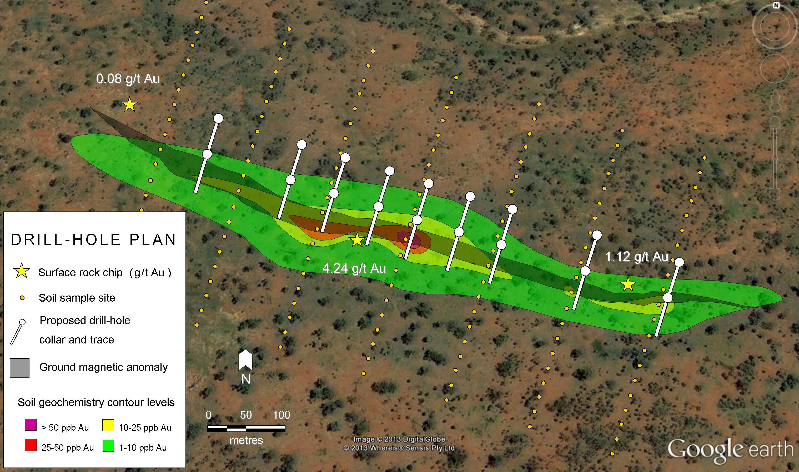
While the results thus far show that there is indeed gold on the property it’s too early to say what exactly Comstock has here. However, the project geology doesn’t sound unlike Kaminak’s 2 million ounce Coffee Project, which is encouraging.
[box type=”info” align=”aligncenter” ]Disclaimer: This is an editorial review of a public press release and may include opinions or points of view that may not be shared by the owners of geologyforinvestors.com or the companies mentioned in the release. The editorial comments are highlighted so as to be easily separated from the release text and portions of the release not affecting this review may be deleted. Please view the full release here.[/box]
VANCOUVER, BRITISH COLUMBIA–(Marketwired – Nov. 7, 2013) – Comstock Metals Ltd. (TSX VENTURE:CSL) (“Comstock” or “the Company”) announces the results of the summer exploration program from its QV project 90 kilometres south of Dawson City, Yukon. The QV project is contiguous to the Kinross Gold’s Golden Saddle project and hosts a similar style mineralization as the Golden Saddle deposit. The Company has completed 3422 metre diamond drilling on the VG Zone in 17 diamond-drill holes outlining a 350 m by 350 by zone that is 250 m deep, and the zone remains open in all directions (as reported in August 1, 2013 News Release).
[box type=”note” align=”aligncenter” ]Comstock’s QV project is one of many projects along the Tintina Gold Belt, or Tintina Gold Province (TGP). The TGP is a 1200 km (745 mi) long and 200 km wide (125 mile) belt bounded by two large fault systems and extending across the Yukon and Alaska. We’ve included a rough map of the belt below. Other TGP projects we’ve talked about included the Donlin Gold Project and Kaminak’s Coffee Project. [/box]

The 2013 exploration program at the QV property included diamond drilling, geological mapping, rock and soil geochemical sampling, ground magnetometer surveys, and prospecting. The results of the drilling program have been reported in the August 1, 2013 News Release. Highlights from the program include:
- Sampling of outcrop at the Adit Fault zone, 450 m south of the VG Zone, returned 5.61 grams per tonne of gold (g/t Au) from a grab sample and 2.90 g/t Au from a channel sample over 0.50 metres.
- Expansion of the Shadow Zone, a known soil anomaly located 14 kilometres to the north of the VG Zone, to an area 2500 m by 1400 m defined by values ranging from greater than 10 ppb Au up to 514 ppb Au.
- Results of rock sampling, via pneumatic hammer drill designed to sample bedrock at the Shadow Zone, returned 1.51 g/t Au.
[box type=”note” align=”aligncenter” ]Comstock’s summer program involved drilling their main previously defined zone and a wider exploration program to identify future drill targets. Their program involved a combination of rock and soil sampling, ground based geophysics and the trenching of target outcrops.
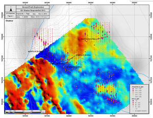
The diagram below, from Comstock’s website shows an overlay of the ground based magnetics and the soil survey results. The geochem survey grids were much smaller and don’t fully overlay the mag survey, but it does seem to show elevated gold along the contact between the moderate and low mag units. The mag and geochem results will be correlated to the local geology, defined by mapping and rock sampling. The final compilation should give the company some targets to focus on. This is the type of work that geologist’s love.[/box]
“The presence of parallel and mineralized structures at the VG Zone including the VG Zone (Telegraph Fault), Adit Fault, and VG North Fault together with the Shadow and Stewart Zones would suggest that the QV project hosts one of the larger gold mineralized systems in the White Gold District of Yukon,” commented Rasool Mohammad, President and CEO. “Our work in 2013 significantly expanded the potential of this project, not only at the VG Zone but also at the multiple gold targets that have been developed over the past 6 months. Compilation of our 2013 exploration results is well underway, and we look forward to a follow-up exploration program in 2014.”
The mapping and prospecting programs focused on parallel structures and mineralization to the Telegraph Fault (hosting the VG Zone) as previously reported (July 22 and August 1, 2013). Sampling was completed on the VG North structure, 1200 metres north of the VG Zone, the Adit Fault, 450 metres south of the VG Zone, the VG Zone area and the Shadow Zone (14 kilometres north of the VG Zone). Gold mineralization with similar grades and geological setting to the VG Zone (Telegraph Fault) was confirmed in these structures. Mapping completed on the Adit Fault shows the host to be a biotite schist with sericite alteration and quartz veining associated with an east-west trending vertical fault (Adit Fault) and low angle shears dipping approximately 30 degrees to the north-northeast. Channel samples previously reported (August 1, 2013) 4.67 g/t Au grab sample yielded 2.90 g/t Au over a 0.50 m-wide quartz vein, 0.083 g/t Au over 1.00 m below the quartz vein, and .676 g/t Au over 0.50 m above the quartz vein. Two grab samples collected seven metres from the channel samples along the vein structure returned 5.61 g/t Au and 3.31 g/t Au.
On the Shadow Zone, two structures have been interpreted from magnetic data and surface mapping. Through soil and rock sampling, the Company also expanded the Shadow Zone target to a 2500 m by 1400 m area, highlighted by a peak gold-in-soil result of 514 ppb gold. Trench sampling in 2012 returned 88 m of 0.33 g/t Au (as reported December 11, 2012). The highest rock grab sample result from 2013 returned 1.51g/t Au. The mineralization at the Shadow Zone is hosted in felsic intrusive and augen gniess rocks. The zone and structures display similar characteristics to the VG Zone.
[box type=”note” align=”aligncenter” ]All of the above is meant to demonstrate that the company has gained a better understanding of the project geology through their summer mapping and exploration. Like many deposits the gold mineralization appears to be related to late hydrothermal activity which brought gold-bearing fluids through a variety of existing rock types, but generally along planes of weakness such as faults and shears.[/box]
The work program on the Walhalla project included rock and soil sampling. The soil geochem has returned values ranging up to 17 ppb Au, 306 ppm Cu, and 1687 ppm Ni. The rock geochem results have returned gold values ranging up to 294 ppb Au, 121 ppm Cu, and 451 ppm Ni. The Company will plan additional grid-soil sampling and trenching for the 2014 work season.
The technical information in this News Release has been reviewed by Duncan McBean, P.Geo.
About Comstock Metals Ltd.
Comstock Metals’ flagship project is the QV Property in the Yukon Territory, which covers 14,180 hectares (35,000 acres) within the prolific White Gold District in the Yukon Territory, about 70 kilometres south of Dawson City. Kinross Gold’s Golden Saddle deposit is 10 km to the southeast, and Kaminak Gold’s Coffee projects are about 40 km to the south.
[box type=”note” align=”aligncenter” ]It’s important to note that all of these described methods are very early stage exploration techniques. While the results thus far show that there is indeed gold on the property it’s too early to say what exactly Comstock has here. However, the project geology doesn’t sound unlike Kaminak’s 2 million ounce Coffee Project: Both oxide and sulfide-hosted gold near to the surface with strong hydrothermal alteration within mixed lithologies. That itself is encouraging.[/box]
[box type=”success” align=”aligncenter” ]Have a company or release you’d like us to look at? Let us know though our contact page, through Google+, Twitter or Facebook.[/box]

